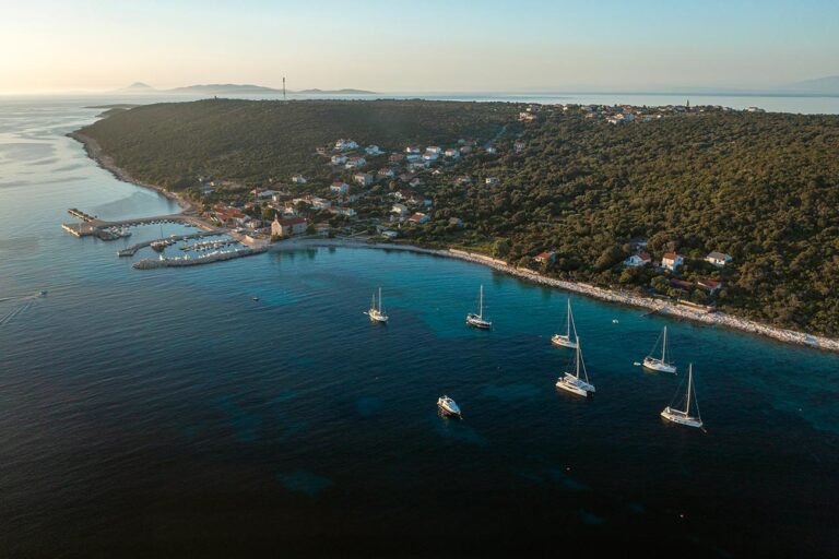
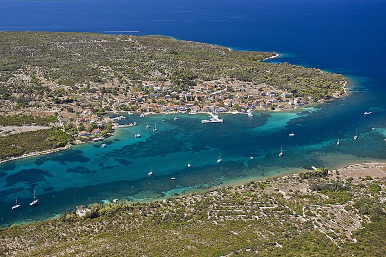
A sailor will instinctively describe Lošinj as remarkable. It is diverse; its towns are well-planned, steeped in history and maritime tradition, and have preserved...
Woven with unquestionable beauty, its coastline is intriguing, diverse and suitable for all sailors, while the interior, which is worth visiting, is lively and picturesque
The distribution
of the Adriatic islands is ideal for every mariner, especially under sail. With
a few blank areas, they run along the entire coast from Rijeka to Dubrovnik.
The distance between them is seldom greater than ten nautical miles, and they
make myriad waterways and channels. The islands and the coastline count more
than 1500 bays, coves, and harbours for mooring and anchoring or an overnight
stay. These places are ideal for sailboats, but motor cruising or fishing rides
are also a treat. Nothing is ever too far away, yet if you want, you can sail
all day long. Navigation in such a variety of shores, coves, currents and local
winds is always interesting. There is always some action on board. To get where
you want, you always have to make sure that you’re still on course and adjust
to the circumstances. In one moment you sail downwind and in the next you tack
or have to manoeuvre through a narrow channel or a strait. The regime is just
as variable for motor boats. The landscape is never the same. You can see
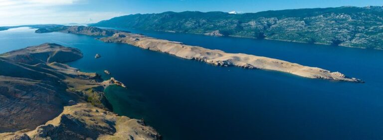
desolate spots hit by hard winter boras, such as the northern coasts of the
islands of Rab or Pag. Shores facing the open sea are usually lush, especially
as you move down south. One moment you will brush along a thick pinewood such
as those on Lastovo or Jakljan, and the next all you see will be brushwood and
bare rocks. You will pass by or moor in typical Mediterranean ports as well as
in small fishermen villages. You will often see solitary coves with a house or
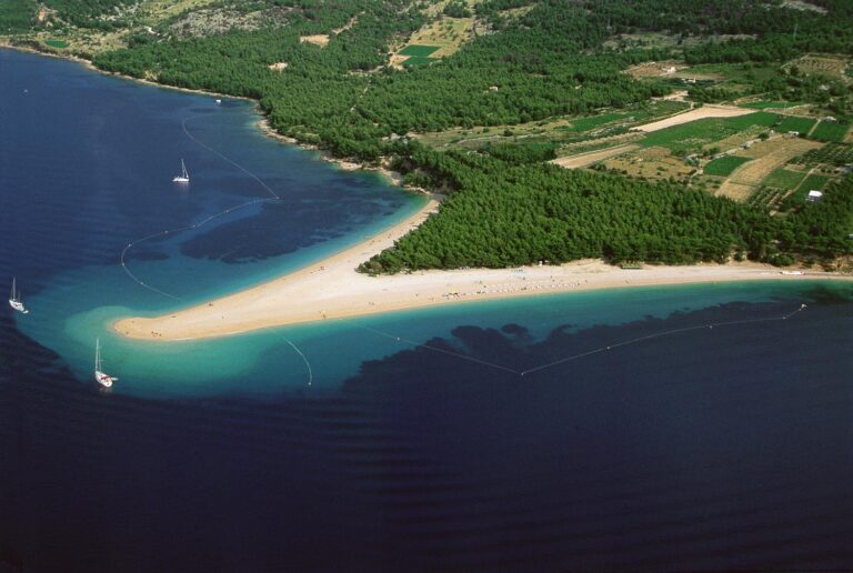
two. You will sea beaches changing appearance with the wind such as Zlatni rat
(Golden Cape) on the island of Bol.
Island places are
never the same and are worth visiting. Some towns such as Korčula, Hvar, and
Vis date back to ancient Greece. Other places are of a more recent date,
usually established as fishing ports or ports of larger island towns situated
further inland. Many islanders lived from the land and built their towns and
villages inland, usually on the slopes bordering fertile fields. Most of these
places have preserved their genuine appearance and quality, and even though
there are but a few residents left, you will be able to catch a glimpse of the
times long gone.
Sitting at the very heart of the
Central Dalmatian islands, at the intersection of sea routes, Brač is 40 km
long and 12 km wide. Its surface area is 395 km², which makes it the largest
island in Dalmatia, and its highest peak, Vidova Gora (778 m) is the highest on
any Croatian island. It is flanked by Brač Channel to the north and Hvar
Channel to the south, and is separated from neighbouring Šolta by Split Strait
to the west. It shoreline is 175 km long, with an indentation index of 2.48.
This places it among the averagely indented Central Dalmatian islands. There
are twenty-three fairly large towns and villages of different sizes on the
island, and a few hamlets, on the coast and in the interior, organised into
eight municipalitieswith 14.500 permanent inhabitants.
Looking over Brač Channel towards the
island, it seems so close to the mainland as to be almost at arm’s length. The
stone waterfronts of its harbours are scenes of life open
to travellers and tourists visiting the island, and the first-time explorer may
feel that everything is at his fingertips. But Brač is special, multi-layered,
and fascinating, unlike any other Dalmatian island. It is full of strange
little corners, secrets, variations, the hard work of its people, the pain and
suffering of abandoned, derelict homes, and the joys of building new ones…
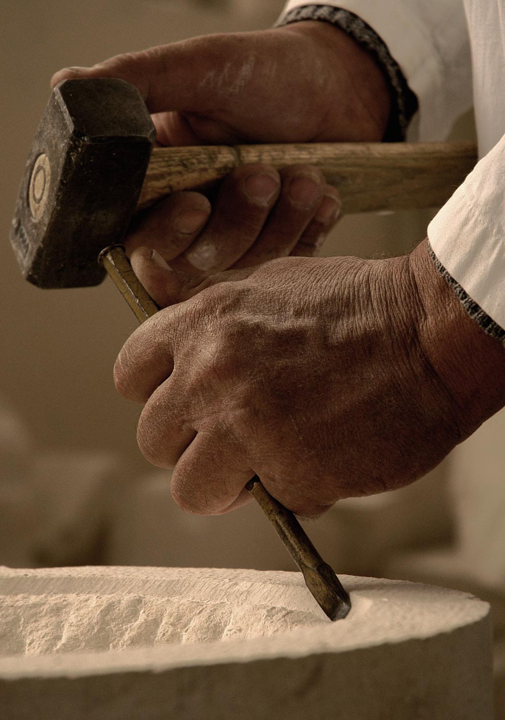
Brač is the stone from which it is
formed. Brač is the piles of stones which cover it from end to end, like a
giant network. Brač is Illyrian mounds and barrows. Brač is the relics of Roman
rule found in almost every bay, Early Christian basilicas, labourers’ stone
cottages, sheepfolds in the fields, towers and mansions, mystical hermitages on
the south shore and Blaca gorge, shepherds’ dwellings and hamlets, tiny
churches scattered in the fields so that God would be near to the working
people, centuries-old olives on the slopes, vineyards on the south slopes,
flocks of sheep grazing from the shoreline to the high plateau on Vidova Gora,
pines which warm half of Dalmatia in winter, coastal villages with Renaissance
and Baroque treasures, modern tourist resorts, and inland villages which
stoutly defend their farming traditions. Brač is churches and monasteries with
tall, white bell-towers, and tiny chapels decorated by the works of long-gone
artists.
All this is Brač. But above all, Brač
is its people. They work hard and care for their island, building, enriching,
and enlivening it. They are its heart and soul. Even if they leave for foreign
parts, there is an invisible thread linking them forever to the island, and
they often return, if only to visit. Since the days when the population left
the blighted vineyards by sailing-ship or steamer for a new life on the other
side of the world, every departure is the first step towards a return. Brač is
the love of its people.
An Irresistible Allure: If you anchor on the island of Premuda, you will be closer to the open sea than at any other anchorage in the Adriatic. It is definitely one of the most intriguing, picturesque and enigmatic small Adriatic ports
It is always nice to sail a different route than most people take. Sailing from the island of Murter to the North Adriatic is certainly such a journey. That is why our editorial trio was justifiably excited when we set out from the Marina Betina in late June of last year toward Premuda and Silba, two beautiful small islands along the route of those sailing south from Istria or Kvarner, which are often reached from the marinas in Zadar but are not a frequent destination for those who maintain their vessels south of Šibenik.
These islands lack the old harbors and coastal settlements we have become accustomed to on the nearby islands of Lošinj, Cres, Krk or Rab. On the contrary, their inhabitants built their scattered houses on the elevations away from the sea. Only in this era of modern tourism, when fewer people live here year round, and the numbers of tourists and sailors are increasing, have houses been built along the enchanting shorelines, which are characterized by a special ambience.
The Krijal ferry pier / Photo: Magazine More
The island of Premuda has one of the most intriguing, picturesque and enigmatic small Adriatic ports
The pristine beauty of all the offshore Adriatic islands is captivating, an attraction difficult to describe to those who have not experienced it. Is it the attraction of the open sea, that positive adrenaline rush brought on by the immense and powerful sea, or is it the sense of security that these islands provide? It is difficult to analyze but the attraction is irresistible.
That is precisely what you will experience if you tie your vessel to a buoy in front of the small harbor of Krijal on the island of Premuda. If you anchor here, you will be closer to the open sea than at any other anchorage on the Adriatic. It is definitely one of the most intriguing, picturesque and enigmatic small Adriatic ports. From southern to the western sides, Krijal is protected by cliffs, lined up like a mighty shield. However, even at first glance it will be clear to you that they yield under strong southern or northwestern gusts of wind.
Cliffs, Buoys, and Solitude: The Tranquil Waters of Premuda
The largest cliff, Masarine, gives its name to the entire group, though each has its own: Hripa, Plitka Sika, Bračić, and Mala Sika. These cliffs, together with the coast, create a lagoon where the sea shimmers in every shade of blue. It reaches depths of no more than five meters. The seabed alternates between sand and Poseidon grass. The constant current keeps the water exceptionally clear, making for a glorious swimming experience. Whether you dive off your boat or take a dinghy to the reef, it’s a delightful experience.
In the channel between Premuda and the line of cliffs, there are many buoys. Some are closer to the cliffs, especially off Masarine, where there is a nice beach. Others are nearer to Premuda and the port of Krijal. Although the concessionaire from Silba, who manages the anchorage, is entitled to anchor 69 buoys, we found only about twenty. That was enough for the dozen sailboats and small motorboats anchored that day along Premuda. We also saw a few more in the coves of Premuda and Zaporat. These spots were chosen by those who enjoy total solitude and quiet. They provide good protection from the north wind and, depending on where the anchor is dropped, from the mistral and south winds. The area also has nice beaches. At one time, an entire fleet of domestic sailing vessels was tied up in the bay of Premuda, but they have long since disappeared.
A steep uphill path leads to the center of Premuda, offering a beautiful view of the small harbor of Krijal. It is separated from the open sea by a thin line of islets—Hripa, the Masarine reef, and the islet Plitka Sika / Photo: Magazine More
In the harbor of Krijal – as close to the open sea as possible
Workers constructed a new catamaran and ferry pier west of the old harbor in Krijal. They surrounded it with breakwaters where locals now tie up their boats. Previously, the pier stood on the northern side of the island in the cove of Loza. Even today, sailors sometimes use it during storms from the south. The Church of St. Cyriacus (Sveti Krijal, St. Cirijac) stands in the harbor. It served as the parish church until the eighteenth century. A cemetery lies next to the church. Local fishermen regularly sail into the harbor, offering fresh fish for sale.
Overlooking the harbor are the restaurants Masarine and Kod Celestina. These are the only places where those who sail here can socialize and dine. We chose Veljko Žuvanić’s Masarine, which has a long tradition. Before the restaurant opened, these premises were occupied by the fishermen’s cooperative, founded in 1903. In the neighboring building is an old oil mill, with rooms for socializing upstairs. This already indicates that despite Premuda’s sparse population and location at the very edge of the open sea, if those who sail here are not too demanding, they can find everything they need on the mainland. Along the way, like us, they can chat with the local people, including those who come here during the summer for seasonal work.
Milenko Kojić expertly prepared dinner for us / Photo: Magazine More
The center of the town is located on a hill, 70 meters above sea level
We became acquainted with Milenko Kojić, a cook who has been coming for the past seven years to work for three months a year in a local restaurant. He calls himself a seasonal resident of Premuda. The lovely waitress, Nina Rale, comes here from Novi Sad. She intends to work in cyclotourism one day. The next day, they were going to be joined by Stipe Kozul from Ražanac, who lives in town (Zadar). We met him that day in the shade of a pine tree in front of a minimarket that operates in two shifts, only during the summer. There are also seasonal employees in the store, Lucija and Ema, the former, who comes here in the summer to visit her grandmother, and the latter, who comes to see her grandmother and grandfather, thereby combining work with pleasure.
Premuda is an island where 50 to 60 inhabitants live year round, not in Krijal but in the center of the town on a hill about 70 meters above sea level. The highest peak on Premuda, Vrh, is only 88 meters above sea level. There is a sign showing the harbor of Loza, the Church of St. James, an out-patient clinic, post office and tourism information center. Some prankster added a panel marked here and there, with arrows that send you in a certain direction.
Barba Leo told us everything about Premuda while we took a walk together / Photo: Magazine More
Postal worker, agent and Uncle (Barba)Leo
The clinic with a sign reading 1986 was closed, the church was closed and we could not locate the tourism information center but the post office was open, where we found everything that interested us. The postal clerk, Meri Lukin, knew the answers to all our questions. She was so delightful that we sent postcards from the island. The post office is in a rented space. Upstairs was a center where young people gather during the summer. We learned that a priest comes from Silba every Sunday, as does a physician, but not on Sundays.
The charming Meri Lukin, part-time postal clerk, part-time Jadrolinija agent / Photo: Magazine More
Meri keeps the keys to the Church of St. James, allowing us to take a look inside. She splits her time between working as a postal clerk and selling ferry and catamaran tickets as an agent for Jadrolinija. In front of the post office, a spacious square stretches out, its surface visibly affected by months of drought and heat. Cypress branches partially obscure a neglected monument, while a rusted stone crusher, draped in a disintegrating tarpaulin that barely conceals an old ARAN motor, blends into the worn-down surroundings. Only the relentless chirping of crickets added rhythm to the stifling summer day.
“Now I’ll call Barba Leo. He knows everything!”
When we told Meri we wanted to meet older islanders who could share stories about life in Premuda, she immediately responded, “Now I’ll call Barba Leo. He knows everything!” Even though it was his dinnertime, Barba Leo—full name Leon Smirčić—hopped on his motorcycle and rode over to meet us. A former sailor, he had spent years working on a tanker that regularly stopped at Adriatic and Mediterranean ports. Since the construction of the ferry pier in Krijal, he has noticed slow but steady progress on the island. Islanders have built about thirty new houses and renovated as many old ones. However, only three or four families have a member with a job, and even then, it’s part-time, meaning they earn only half a salary.
At the highest point of Premuda stands the Church of St. James / Photo: Magazine More
In the center of Premuda
In the past, islanders raised sheep and crafted high-quality cheese, much like the kind made on the island of Pag. They cultivated potatoes and various other vegetables. Farmers sent their olives to Zadar for processing into premium oil. For generations, the people of Premuda worked as seafarers, building an enviable fleet that kept emigration lower than on other Adriatic islands. Electricity finally reached the island in 1971. Premuda’s first settlers, skilled stone cutters, quarried stone and produced lime. Their main harbor was Loza.
Tending the vegetation along Premuda’s paths and streets / Photo: Magazine More
The fishermen had their storage sheds in today’s Krijal. For Loza, the biggest problem was the north wind, bura, and for Krijal, the worst was the levant (pulentada). Barba Leo expressed this vividly: The pulentada stirs up chaos in the harbor. Slovenians, Austrians, and Germans make up the majority of visitors to Premuda. We visited the store, which was much larger than the summer minimarket in Krijal. In its shaded entrance, two like-minded locals passionately debated politics, local elections, results, and the unprincipled coalitions formed by the parties they had supported.
Life on Premuda: City Vibes in a Small Island Setting
One would say that everything is the same as in a large city, only on a smaller scale! While we were walking through the streets of Premuda, which meandered among gardens and were ornamented by numerous oleanders in full bloom and an abundance of wild plum trees, a maintenance team from Zadar suddenly appeared to mow the already dry grass and also transport garbage from the island on a special ferry line. Like us, they sought refreshments at the restaurant Masarine.
The previous evening, Milenko Kojić had masterfully grilled a sea bass for us, and Nina served it. We learned that the owner of the restaurant, Veljko Žuvanić, produces island gin, Luftbremzer gin. Tasting Adriatic island gin is an interesting experience. After enjoying grilled sea bass the night before, we craved fried smelts for lunch. The two types of fish differed significantly, but the meal did not disappoint us at all! Promising ourselves to return, we set sail contentedly toward Silba.
Text: Braslav Karlić and Marko Vučetić Photos: Mladen Šćerbe and Marin Srzić
In late spring, we sailed around an island off the main nautical routes. We discovered numerous reasons to visit the Island of Pag and explore its harbours.
As the fifth-largest and most indented island in the Adriatic, Pag hasn’t been favored by recreational sailors or chartered yachts. Its elongated shape, deep southern bays, and lake-like Pag Bay suggest it would be bustling with sails and motorboats, much like areas around Hvar, the Kornati Islands, or Lošinj.
However, Pag’s waters see significantly less nautical traffic. Routes from the north to the south typically follow the outer chain of islands from Lošinj to Dugi Otok. Sailors from Kvarner marinas stick to Kvarnerić, while those from Vinodol Channel ports are drawn to Rab’s Kalifront coves and the enchanting town of Rab. Thus, Pag’s southwestern coast is often overlooked, and its northeastern side facing Velebit and the bora wind even more so, making it one of the least navigated areas of the Adriatic.
Limited Moorings
Except for Novalja and the marina in Šimuni, there’s been little investment in harbours here. Consequently, there are few transit moorings, and the only fuel station for sailors has closed. To refuel, one must head to Rab (20 NM) or Zadar (18 NM). This issue was temporarily addressed by mooring a boat equipped as a fuel station.
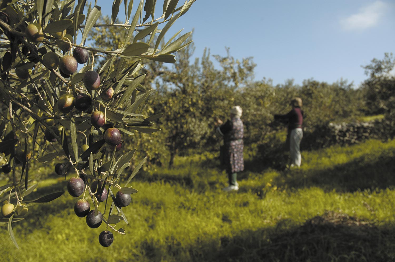
The olive groves of Lun, Pag Island / Photo: Mladen Šćerbe
So, is it worth sailing to this island of salt, sheep, cheese, and recent decades of vibrant nightlife? Absolutely. From a boat, you can experience a different Adriatic than you’re accustomed to. While finding moorings and monitoring weather forecasts may require extra effort, the rewards are plentiful. You’ll witness the ancient olive groves of Lun after docking in a small harbour on this peninsula pointing towards Rab.
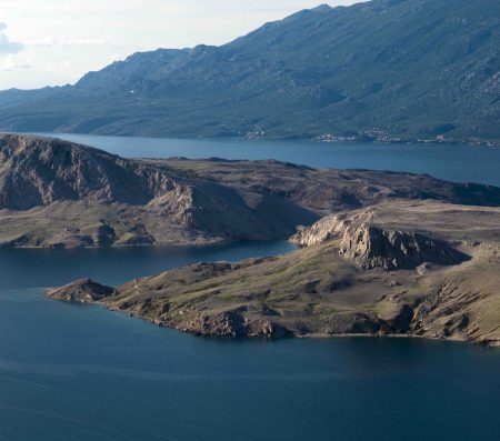
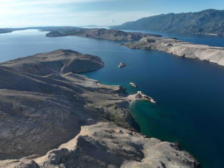
Those seeking Ibiza-like parties will head to Novalja and nearby Zrće. In the town of Pag, unique for its urban design, lace, and saltworks, you’ll journey back to the 15th century, to a time of its creation following principles reminiscent of ancient Roman planning. For complete solitude, anchor in the harbours of Povljana or Dinjiška. And then there’s the barren northern coast with its moon-like landscape, unmatched anywhere else.
Lun – Pag Island’s northernmost harbour
Pag Island Sailing In Croatia Jakišnica / Photo Mladen Šćerbe
Approaching Pag from the Kvarner islands or coast, the first encounter is the long Lun Peninsula. You can moor in Tovarnele, Pag’s northernmost harbour, or slightly south in Jakišnica. Here, you’ll find a landscape quite different from the rest of the island. This is its greenest part. Excluding the barren northern coasts, thousands of olive trees grow here. It’s estimated there are 80,000, alongside countless holm oaks.
Lun is renowned for its significant number (about 1,500) of olive trees with roots reaching deep into the past. Researchers believe they are at least 1,500, possibly even 2,000 years old. These impressive Methuselahs were created by grafting the oblica variety onto wild olives, a cultivation method preserved to this day. This persists despite modern times viewing physically demanding work as less valuable.
Tovarnele and Jakišnica
Whenever I’ve visited this area, I’ve left convinced that olives hold the same significance in residents’ lives as they did for their ancestors. Take the opportunity to visit the presentation center in Tovarnele and stroll through the Lun olive groves dedicated to them.
You’ll see the care and love locals invest in them. They prioritize ecological production, continue to raise sheep grazing freely among the olives, build and restore dry stone walls, and tend even to neglected trees whose owners have moved away. Be sure to purchase a bottle of oil here. If you’re looking for a good meal, follow us to Palma by Davor Badurina in Jakišnica. In the absence of Pag lamb (gone by early May), we enjoyed boiled scorpionfish and squid.
Pag Island Sailing In Croatia Davor Badurina / Photo Mladen Šćerbe
Leaving Lun, we reach its base and the over two-mile-long Stara Novalja Bay on the north, and the large Novalja harbour on the south. Greenery still surrounds us, especially where it hasn’t given way to mass construction. Notably in Novalja, which over the past 25 years has transformed into a resort for those seeking parties and all-night fun. Although most of this occurs on Zrće Beach on the island’s other side, Novalja also exudes this somewhat wild atmosphere. Keep this in mind if you plan to visit.
Harbor for Fishermen and Boaters
Let’s first see if there’s a chance to find a berth in Novalja. The local harbor is a wide bay open to the west and exposed to storms. A secure berth here is crucial, as the locals well know. To protect the waterfront and part of the harbor, a breakwater more than two hundred meters long was gradually constructed. Later, a pontoon was added. For this fast-growing town, it wasn’t enough, so a few hundred meters further west, another jetty was created. Local boats tied up there. It is equipped with moorings, electricity, and water facilities and is managed by Port Authority Novalja. On the first jetty, there were places for about twenty or even more vessels in transit.
But as a considerable fleet of purse seiners and local fishermen sail in the Kvarnerić and further towards the open sea, Novalja became their nearest unloading port. Thanks to the bridge connecting Pag island with the mainland, it’s only about sixty kilometers from the highway. Due to this, the outer jetty was completely refurbished, expanded, and transformed into a fishing harbor.
This certainly benefited the fishermen, but boaters visiting Pag felt the consequences. Local boats, including yachts, of which there are quite a few, had to move to the inner jetty. Thus, the number of berths available for vessels in transit decreased. In the meantime, the previously mentioned fuel station for boats was also closed, and to compensate for it, a floating fuel station called Sea Gas Point was anchored.
Abandoned Marina Plans
There was also an intention to build a marina in the harbor. Despite extensive preparations a few years ago, local authorities abandoned this plan. For now, visitors who arrive by yacht and cannot find a berth have only the option of anchoring. The harbor is relatively shallow, and its inner part does not exceed five meters in depth. Thus, in the season, about ten buoys managed by the local port authority were anchored there. Berths on the waterfront and pier are used by a catamaran line and excursion boats.
Fortunately, just a few months after our visit to Novalja, work began to expand the waterfront by the fishing harbor. Pontoons will be anchored there, and the southern breakwater will also be extended.
It’s hard to say how many boaters stop in Novalja intending to spend the night at one of the clubs on Zrće beach. Certainly, the number is significant. The town itself, which has grown uncontrollably in recent decades, is deeply marked by these activities. Most offerings consist of casual eateries and various types of bistros that can be found everywhere. Of course, you can find places with a much more local flavor. Dražen Šegota, a sailor operating the ferry line from Tovarnele to Rab, introduced us to one. We had an excellent experience at the Pod zvon tavern-pizzeria. The pleasant atmosphere, good food, friendly and fast service, and reasonable prices made us note this as a place worth returning to.
Stara Novalja
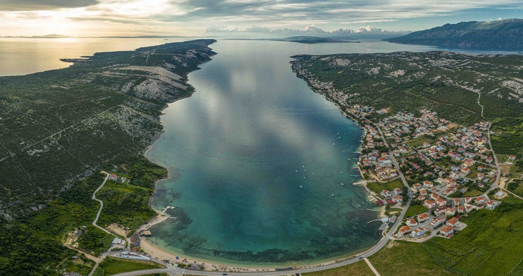
To reach Stara Novalja from Novalja by sea, you must sail nearly 23 miles around Lun. Over the hill, it’s just a few kilometers, so it’s wiser to drive unless you intend to sail the Velebit Channel around the northern coast of the island. Today, Stara Novalja (Old Novalja) is anything but old. The former miniature settlement has expanded into three rows of newly built, quite large houses stretching three kilometers along the northern shore of the bay, almost to the ferry dock.
Pag Island Stara Novalja Bay / Photo – Mladen Šćerbe
Fortunately, the beach at the bottom of the bay and the entire southern shore have remained untouched. For those sailing here, Stara Novalja doesn’t offer much. There are no berths available in the settlement itself. However, anchoring at the end of the 2.2-mile bay is possible, providing protection from the bora wind but not from the tramontana. Near the ferry dock at Cape Deda, there is a quay accommodating about ten boats. There’s also a plateau used for hauling out and repairing boats, managed by the local port authority, where you might occasionally find a berth.
Michelin Star, Sheep, and Cheese
This part of the island is also home to Boškinac, one of the most important gastronomic and family tourism projects in the Adriatic. It was created by Boris Šuljić, who forty years ago opened Calypso, the first small beach bar on Zrće, igniting the transformation of that beach into what it is today. A few kilometers away, he launched an entirely different project.
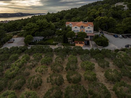
On wooded slopes above the isthmus connecting Stara Novalja and Pag Bay, he built a luxurious family hotel with a restaurant and wine cellar. He surrounded it with olive groves and vineyards. Persistent and visionary in preserving Pag traditions and perfecting them, he created a place of relaxation and fine dining of the highest standard.
Together with chef Matija Bregeš, he earned and maintained a Michelin star. They added high-quality wines labeled Boškinac, suitable for long aging. If you visit this part of the island and want to experience top-level fine dining and seasonal island produce, Boškinac is the right place.
Pag Island Boris Šuljić, Boškinac/ Photo – Mladen Šćerbe
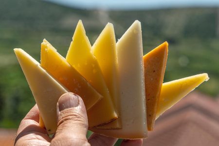
Speaking of delicacies, Pag island has always been famous for sheep, lamb, and cheese. In the Adriatic, it’s followed by Brač in general sheep farming and Cres in raising sheep, but neither can match Pag. Despite modern tourism challenges, locals haven’t abandoned sheep farming.
Pramenka and Pag Cheese
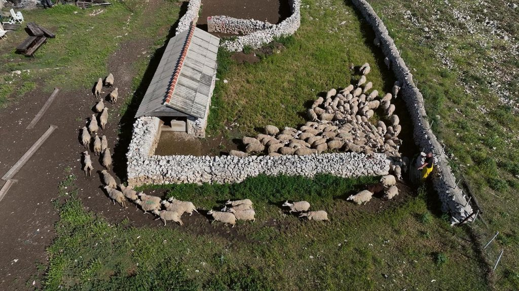
Wherever you move across the island, you will encounter local pramenka sheep in fields or rocky terrain. Dry-stone walls, crisscrossing the entire island and sometimes descending to the sea like those in Kornati, keep flocks together. At this time of year, most lambs have already met their fate as the famous Pag lamb. However, sheep milking continues, as their milk produces the most famous island product—Pag cheese.
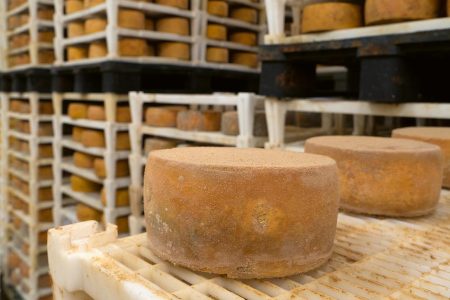
Traditionally, local shepherds made cheese. But seventy years ago, when branded under Paška sirana (Pag Cheese Dairy) and winning international awards, Pag cheese production turned into a major movement. Today it can be found both with small sheep farmers and larger cheese producers, modernized and scaled up to hundreds of tons annually. The most famous among these are MIH and Gligora, the latter having the largest facility on the island.
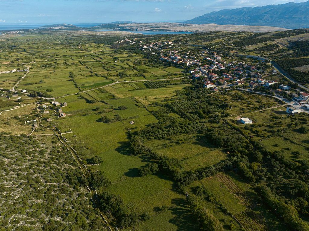
Kolan Field / Photo – Mladen Šćerbe
Gligora cheese / Photo – Mladen Šćerbe
Both dairies are located in Kolan. They have their own herds, collaborate with other shepherds, and produce various cheese types, including cow’s milk cheese. If you have the chance, visit them, taste their cheeses, tour the production, and buy something. You won’t regret it. Gligora’s facilities, aging a hundred tons of various cheeses at once, left us speechless. Afterward, we tasted nearly all in their Cheese&Caffe, which offers beautiful views of Kolan’s green fields. We also visited Paška sirana shepherds near Košljun and observed their afternoon milking.
The sheep are heading out for their afternoon grazing
The Only Marina on the Island
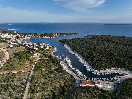
Kolan is most easily reached from Šimuni, the only place on the island that has a marina. It belongs to ACI, and only privately-owned boats are moored there. It occupies the northwest part of a large, well-protected natural bay. Although the settlement near the marina has seen considerable development in recent years, the marina remains peaceful. Here, you’ll find yourself in a completely different environment compared to Novalja, for instance. It lies slightly outside the main sailing routes but offers beautiful waters ahead.
The island of Maun is just two and a half miles away, Škarda is only slightly further. To reach the lovely coves of Olib, it takes about ten to twelve miles. If you leave a thirteen-mile wake behind you, you’ll find yourself already at Silba. The marina has a restaurant, with several more located in the village. The best among these is certainly Didova Kuća, run by Gordana and Kristijan Fabijanić. They are descendants of the first family to settle in Šimuni. They are renowned for excellent, varied, authentic Pag cuisine, and a unique ambiance and tableware which they craft themselves. Stipe Žunić, the young marina director, told us the marina is well-occupied but always has around twenty places available for transient boaters.
ACI marina Šimuni and its manager Stipe Žunić / Photo More magazine
We could continue along the southern coast of the island, anchoring off Košljun or Povljana, although berths there are scarce. Alternatively, we could enter the bays of Povljana and Dinjiška on the eastern part of the island. However, we’ll leave that story for another time and instead head towards Pag. Sailing there and staying in this Renaissance town is a unique story in itself. It’s difficult to compare it with any other Adriatic location.
Through Paška vrata to Pag
Whether entering Pag Bay from the east or west, we sail along a harsh coastline whipped by the bora wind. When it starts blowing strongly—something I experienced here once—the Velebit Channel becomes dangerous. Apart from a small section of Žigljen harbor and the previously mentioned bay of Stara Novalja, there’s no place to find shelter.
Paška vrata, the western part of Pag Bay, and the Velebit Channel in the background / Photo by More magazine
Therefore, if weather conditions aren’t favorable, sailing here shouldn’t even be attempted. But when Aeolus permits, you’ll experience both the harshness and beauty of this coast simultaneously. You’ll quickly understand why Pag is called a lunar island. Its barren landscapes, secluded beaches, and deep blue sea merge into an unprecedented yet strangely calming sight. During a bora wind’s fierce gusts, with the sea steaming and waves powerfully striking the coast, we’re reminded of our vulnerability before nature.
Paška vrata, one and a half miles long and half a mile wide, serves as the entrance to the spacious bay. For sailors caught by the bora, it provided refuge from its fiercest blasts. Here, they could anchor beneath the northern shores or moor at the Pag waterfront. Who knows how many sailors, in the age of sailing ships navigating along Pag island, owe their lives to this bay?
Nowadays, during good weather, we can anchor near some beach. From there, we can continue sailing, passing charming villages like Metajna, Zubovići, Kustići, and Vidalići, towards Caska and the bay’s western shore. Finally, we can anchor near Zrće and indulge in the rhythm of its nightlife. Many yachts, some up to fifty meters long, choose this route through Paška vrata.
In the Town of Pag
We choose to head to Pag, hoping to find a berth at the waterfront or by the small breakwater at the former ferry dock. If we succeed or anchor nearby, we gain access to a town worth every mile we’ve sailed to reach it. Here we can discover important layers of its history.
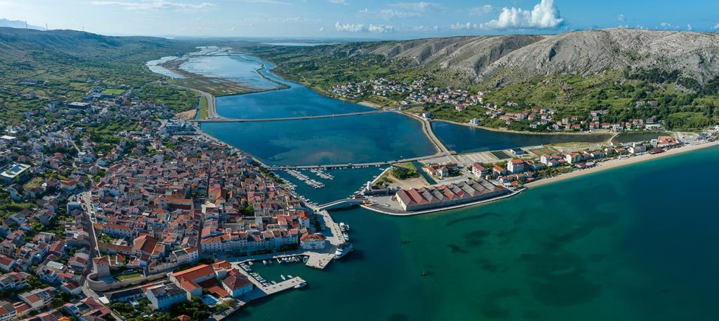
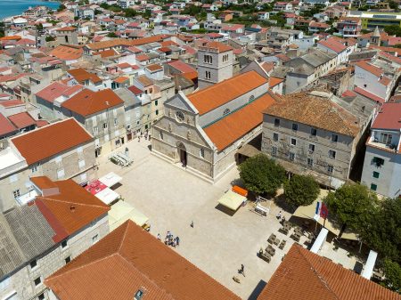
Inhabited since Illyrian times, Pag received a defining feature during Roman rule—a salt pan. In the mid-15th century, construction began on a new town of remarkable urban planning and beauty. Under the guidance of renowned urban planners and builders of the time, reportedly including Juraj Dalmatinac, the town was carefully designed. It features a network of regular streets intersecting at right angles, and a central square. All of this was built in a typical Renaissance style within defensive walls and towers. The poor strategic position of the former Pag on the opposite side of the bay was precisely why the new town was built.
Beauty with Measure and Harmony
The main town square and freshly bought baškotini / Photo – Mladen Šćerbe.
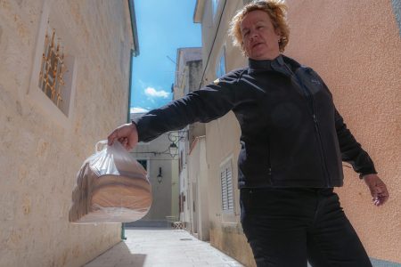
When you disembark on the Pag waterfront, you can stroll its streets, sit in the square, visit the cathedral or the Benedictine monastery, and buy famous baškotine. You’ll reflect on how modern times, dominated by machines and ruthless builders—with some honorable exceptions—have set us back. We’ve drifted away from beauty, where everything was created thoughtfully, with measure and harmony.
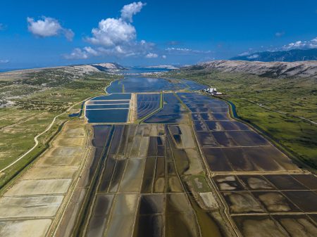
Therefore, let yourself enjoy a town that remains peaceful and uncrowded even today. Visit the salt fields and experience their program “Mornings in the Salt Fields.” Discover the painstaking labor once needed to bring these white crystals to our tables at the Salt Museum. The museum is located in former salt storage warehouses, right across from the waterfront where you might have managed to dock.
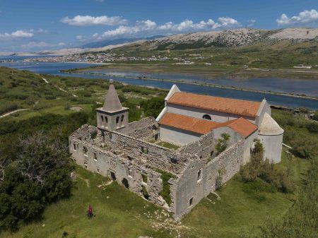
The Pag saltworks and the remains of the Romanesque Church of the Assumption of Mary at the site of the former town / Photo – More magazine.
Pag Lace
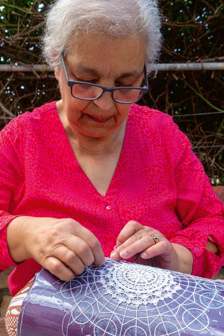
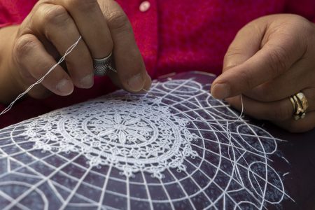
Do not forget to visit the Lace Museum located in the main town square. There, you’ll learn everything about this important part of the town’s identity. Even today, when everything we desire seems to come from China, a lace-making school still exists here. Two hundred women and one man in the town have completed it. Many of them continue to make lace at home.
We visited Mrs. Ankica Oguić, a skilled lace-maker who showed us how lace is crafted using a needle. She demonstrated how combinations of ornaments are arranged to create lace, expressing the personality of its creator. She explained that the finished lace must be stiff enough to stand upright on three fingers without any adhesive, among other fascinating details.
If you prefer comfort and good food, coffee in the main town square, shaded by the cathedral and overlooking all this beauty, is simply better than elsewhere. You will eat well without spending too much at Natale restaurant and Boduli and Bile taverns. After experiencing all this, sail off to one of the beaches in the bay to enjoy the sea and sun.
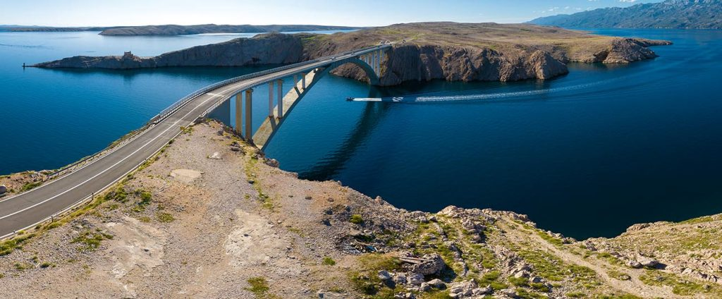
Pag Bridge / Mladen Šćerbe
We will leave this town and Pag island, sailing along its northeastern coast until we pass under the bridge connecting it to the mainland. Then we’ll continue past the previously mentioned bays of Dinjiška and Povljana. From there, we’ll sail through the channel between Pag and Vir, eventually reaching waters crowded with hundreds of sails and motor yachts. Pag is truly a different world.
Vis is located at a point from which everything on the Adriatic is accessible and manageable. Neither large nor small, the island of Vis has a rich history, from the Hellenes, who established a city with ramparts, houses along a street grid, with a waterfront and necropolis, followed by the unruly Illyrians; the Romans, who gave it a theater and thermal baths; and the Croats, who settled there in the tenth century and several centuries later built Renaissance country palaces and, in the nineteenth century, civic buildings and institutions. Vis is a strategic point for trade routes and the site of naval battles that determined who was the master of this sea. It is an island of the bourgeoisie, fishermen and farmers. Above all, there is a unique ambience in Vis, which is sprawled around the harbor of Sveti Juraj, in Komiža, which is squeezed in the base of its bay, and in the fields in the interior, covered by grapevines, with room only for the villages scattered around their edges.
Island of Vis – Main Toponyms; Map More Magazine
However, Vis is most of all a marvelous island! For those who come here with their boats, it offers a lot. Give it the time that it deserves—a minimum of ten days. Only then will you experience it in its full splendor and sail into at least some of its fifty-four coves. You will become acquainted with its two largest towns and the local people, and dine at their tables. You will have the opportunity to go into the interior, walk around the fields, visit the villages and climb Mount Hum.
The feeling as we approach the island, when its coves become more clearly visible with every mile, has remained the same. Stončica inexorably grows before us. We pass the lighthouse on the islet of Hrid Krava, we leave the islet of Host behind on the right and sail into the harbor of Vis. It is Thursday and the harbor of Sveti Juraj is not crowded. Most of the charter vessels have sailed away and the crews change on Saturday mornings.
Kut; Photo by Mladen Šćerbe
We moor at the village of Kut, where sanitary facilities for seafarers were installed in the new, well designed, spacious reception building. Forty vessels can now moor at the enlarged waterfront. There is also a new restaurant here. We try to count how many of them are in this part of the town: Težok, Vatrica, San Giorgio, Val, Pojoda, Tramontana, Mote i Grgo, Kaliopa and another one is under construction. During the socialist period, the only restaurant here was the Lambik. The best dish served there was grilled fillet of yellow tail. What a lot of progress there has been since then! Five hundred people can eat at the same time at the restaurants in Kut, three of which are excellent. For me, the Pojoda is the best of them all, owing to my friendship oncewith Zoran now with Marko and Vesna, and the high quality of the food they serve. Naturally, we spent the evening together and dined with them. However, first of all I wanted to go to the waterfront in the harbor.
Guests eagerly awaiting grilled Flounder at Pojoda; Photo by Mladen Šćerbe
A walk in Vis entails more than a stroll from the Czech Villa to the cove of Stonca, as it is also a journey through the history of the city, including the villa built by the ship owner Topić whose remake is now becoming a hotel, a cemetery for the British sailors killed in 1805 during the first battle of the War in the Adriatic, the fishing harbor of Lučica, the Renaissance palace in Kut, the fortress of Batarija, the beach of Kalafotovo, the excavations of ancient Issa and the Prirova Peninsula.
When we reached Kalafotovo by taking a narrow footpath, the beautiful waterfront stretched before me. The waterfront had been seriously damaged and needed repair and reinforcement. It has been widened by approximately a half a meter with the construction of a wall, under the sea and above the sea, and all the infrastructure and equipment have been replaced.
Amphorae in the Vis Museum; Photo by More
The Beauties of the Coves of Vis
The next day we sail to the town of Komiža, along the eastern and southern coasts of the island and a series of beautiful coves.
The first of them is Stončica. However, before reaching it, we pass the coves of Stenjalo and Dobra Luka on the right. Although they are excellent shelters from the southern and western winds, we do not see any large boats at anchor. As we pass them, in front of us is the cape of Rt Stračine, which, together with the cape of Rt Stončica, on which there is one of the prettiest Adriatic lighthouses, encloses a deep bay where there are three coves with some attractive old houses.
Stončica Lighthouse; Photo by More MagazineAnchorage in Stončica Bay; Photo by More Magazine
The bay is deep, a full seven cables. Several buoys are anchored in Stončica, with a couple of sailboats tied to them. The crew is evidently fooling around on the sandy beach or they have found something to eat at the restaurant Stončica, operated on the island by the Lincir brothers. The Lincirs own purse seines, in which they catch excellent fish around the nearby cliffs and islands, so they never run short. They are known for dishes prepared in a baking bell (pod pekom) and grilled meat, and offer good traditional dishes such as dropčića, known on the island as Vis sausage.
East Coast
From the cape of Rt Stončica, the northern coast of the island ends and the eastern coast begins. Right next to the cape are the coves of Mala Smokova and Vela Smokova. Uninhabited, extending five hundred meters inland, exposed to the easterly wind (levant) and choppy when the south wind (jugo) is blowing, they are protected from western and northwestern winds and not particularly popular with seafarers. All the way until a mile and seven cables from Milna, the coast is not indented. The attractions for us who sail are certainly the islets of Greben, Mali Paržanj and Veliki Paržanj, and the cliffs of Pupak, Žuberka and Pločica, the islets of Veli Budihovac (Budikovac) and Mali Budihovac, and Ravnik, which extend parallel to the coast for three miles, all the way to the cape of Rt Polivalo, where the southern coast of Vis begins.
Budihovac and sailing into the lagoon it forms with the Sanak reef and Mali Budihovac
We go to the lagoon of Budihovac, right across from Zaglav, yet another attractive sandy beach and cove sheltered from the mistral. The islet is like a dream. From the one side is a white gravel beach and from the other, Mali Budihovac and the cliff of Sanak. The sea is clean and clear here, so in the lagoon they enclose there are always small vessels and yachts full of swimmers. So now we stop in front of the beach, next to which is Andre Slavić’s small restaurant. We skip lunch because we ate too much last night and devote ourselves to swimming and enjoying the sea.
Two hours passed in a flash and we weigh anchor. We sail along the island of Ravnik and its Green Cave (Zelena Špilja), where an entrance fee is collected during the summer, and by Rukavac, with five or six boats at anchor. There used to be a small fishing village in the harbor of Rukavac but later a large number of vacation cottages were built, which diminished some of the local charm. In the inner harbor in Rukavac are three inns, the best of which is the Dalmatino, right near the pier. It is run by Sandro Karuza and offers traditional local dishes— pita bread, grilled sardines, salted fish …
The harbor is the largest and most sheltered on this part of the coast. It has two branches that share a small peninsula, at the tip of which is a fifteen-meter-long pier. The cape of Rt Polivalo protects the western part from the summer mistrals, as do the islets of Ravnik and Budihovac from the south and east, although not as well. The innkeepers have anchored several buoys for seafarers.
Mala Travna and Senko Karuza; Photo by Mladen Šćerbe
We also stop at Srebrena, the most beautiful beach on the island, pass the coves of Vela Travna and Mala Travna, where Senko Karuza—chef, winegrower and writer—has an inn. We anchor for a short time in front of the cove of Stiniva, board the dinghy, enter the cove and once again marvel at its exceptional beauty disrupted by the crowds of tourists wanting to see it.
We sail on to Komiža without stopping, merely glancing at a couple of small coves and high cliffs where albatrosses are nesting.
Stiniva as it once looked; today, it is crowded with excursionists; Photo by More MagazineExcursion boats in front of Stiniva; Photo by More Magazine
Komiža
Komiža does not have large crowds. We find a berth at the breakwater, one of the last ones free, and there are also about fifty buoys here on its northern and southern sides. The most beautiful fishing village in Dalmatia is nestled in the corner of the bay, below Muster, and the nearly six hundred-meter-high Mount Hum. Komiža is truly one of the wondrous places in the Adriatic. The Komiža waterfront is not large but I do not know of any other fishing village pulsating with so much or with a similar sense of local tradition. You can sense this everywhere, especially in the fishing museum we visit every time we moor here and discover something new. We take a stroll along the waterfront, have coffee at the Speedo, and then eat supper on board.
Port of Komiža; Photo by More Magazine
This day was devoted to Komiža. The weather was sunny, ideal for visiting the Blue Cave (Modra Špilja) on the island of Biševo. Then, a little after ten o’clock, a beautiful flotilla of approximately twenty sailboats and motor yachts, as well as several large dinghies carrying day-trippers, sailed toward the Blue Cave, and also a liner. Due to the large number of those who want to visit the Blue Cave, it can only be accessed by Nautical Center vessels from the cove of Mezoporat.
We’ll go to Biševo next time.
All excursion boats, yachts and sailboats moor in Mezoporat or can anchor without charge at the buoys for two hours. All the necessary infrastructures for receiving visitors have been built there. A few years ago, the waterfront, at which ten vessels can moor, was expanded. There are also a souvenir shop and a very nice prefabricated building where you can find something to eat and drink. Moreover, there are now a biological wastewater treatment plant, new toilets for invalids and an anchorage with eighteen buoys. Bravo!
Muster, Komiža; Photo by Mladen Šćerbe
We spend the rest of the morning touring Muster, the fortified church of St. Nicholas on the hill dominating the bay, the church collection, and then go down to the Venetian castle of Komuna on the waterfront, where there is an exhibition on the Komiža fishing tradition. We go in to experience some of this tradition, inspect old fishing tools, and also the Cicibela, the last authentic wooden Komiža fishing boat (gajeta falkuša). Fortunately, two new ones are anchored today in the port. The sea is calm. We unmoor, spend the afternoon at anchor in the cove of Barjaška and then return to our berth.
Fort Komuna on the Komiža waterfront; Photo by More Magazine
The evening is reserved for supper at the restaurant Bako,run by the Borčić family. We always eat good fish there. Much attention has been paid to the inn’s décor. It has a good hydroarchaeological collection assembled by the diver and coral diver Tonko Borčić. We savor one of the most beautiful views of Komiža here.
At Bakot and in front of Speed; Photo by Mladen Šćerbe
The Side Exposed to the Bura Wind
The next day, we set sail back to Vis and headed to the northern side of the island. Leaving the Komiža Bay, we will pass by the coves of Perna, Barjaška, and Knezice, all three with beautiful pebble beaches. Rounding Cape Barjaci, near the islets Veliki and Mali Barjak, we emerge onto the rugged and desolate side exposed to the bora wind. When it blows, sailing along this coast becomes dangerous.
Coves Oključna (left) and Tiha; Photo by More Magazine
Passing along the coves of Oključna and Tiha reminds me that this coast has its charms and I have to come back here once and drop anchor, perhaps when the southern side of the island is very hot and the Italians invade it. That would be the moment to sail to this side of the island and find some peace and quiet. Rogačić, the harbor before the entrance to Vis, is nicely filled with boats.
Port of Rogačić; Photo by More Magazine
Vis Again
This time we tie up at Luka. It is fairly lively, although only about twenty boats are moored there.
Waterfront at Luka; Photo by More Magazine
We go for a drink at the Lola, a tavern and bar. The lovely courtyard of the old palace is quite full but some of the terraces have a more intimate atmosphere. You feel as if you were there alone. Ivica Grgić and his Spanish wife, Puri Lojo, will offer you interesting dishes that somewhat resemble tapas but with local ingredients. Nevertheless, we had already decided to go to the restaurant Kantun. The grilled lamb ribs and salad there were scrumptious.
We could have also visited Peskarija, a newly opened, beautifully designed bistro and wine bar run by the younger generation of the Lincir family. In the morning, it operates as a fish market where they sell their own catch, and later in the day, it transforms into a dining spot specializing in blue fish. The dishes are prepared by the talented and energetic young Vis chef, Ivan Poduje.
Evening view of Peskarija; Photo by T. Lincir
On the last day of our adventure, we remain moored at Luka and our means of transportation will be rented bicycles. With them, we shall climb the old but nicely renovated road that connects Vis and Komiža, passing through vineyards and connecting all the inland villages. The road has branches that lead to all the coves on the southeastern side of the island. One leads to Mount Hum, another to nearly all the villages in the center of the island, along which are numerous inns, wineries and rural households. We spend the day going around them, tasting wines and savoring pita bread filled with salted anchovies (komiška pogaca) in the wine house Aerodrom next to the former site of an Allied airport at the end of the Second World War.
We also visited our friend Andrzej Kondrat and his wife Eva at their estate, Kula, in the heart of Dračevo Polje. Now naturalized islanders, this Polish winemaker, together with local enologist Monika Roki, founded the Monissa winery, expanding vineyards and producing top-quality Bugava (Vugava).
Monika Radišić Roki and Andrzej Kondrat; Photo by Mladen Šćerbe
Had we had more time, we would have taken a detour toward Podstražje and Milna to visit the Vislander winery—the largest and most modern on the island. Built on old family vineyards, it was established by Marko Vojković and Damir Radica.
We set sail past Prirovo, one of Vis’s landmarks; Photo by Mladen Šćerbe
The next morning we sail to Trogir and make a couple of stops. We are going away, and hundreds of boats are coming toward Hvar and Vis.
When sailing around Hvar, it feels as though you are passing from one world into another. Along the island’s eighty nautical miles of coastline, the scenes and landscapes constantly change. The vibrant and exuberant town of Hvar, with its Pakleni Islands on the southwestern coast — here, everything brims with life, and hundreds of boats crisscross the Pakleni Channel. The sun-drenched coves of Milna and Dubovica, with their white, virgin beaches, await those heading east along the southern shore. Further toward Sućuraj, at the eastern tip of the island, the coastline becomes harsh and inhospitable. It offers no shelter to sailors, but their gaze is rewarded with steep slopes of Sveta Nedilja, Ivan Dolac, and Zavala, where vineyards seem to reach toward the sky. Just like in ancient times, safe harbor can only be found on Hvar’s satellite island — Šćedro. The Hvar hills fade away and descend toward Sućuraj, a village seemingly making its way toward the mainland and the mouth of the Neretva River.
Northern Side
On the northern side, all the way to Jelsa, we find ourselves in an entirely different environment. Instead of the open sea to the south, here our view is closed off by the rugged Biokovo mountain range. If the northeasterly winds descend from Biokovo, it will be difficult to find shelter before reaching Jelsa, 22 miles away. In the solitary coves of Bristova, Pokrvenik, and Stiniva along this route, the inhabitants are more oriented toward the fields that climb up the hills behind them than toward the sea.
Again, a completely different scene unfolds around Jelsa and Vrboska, two charming towns on the northern coast. Both Jelsa with its harbor and Vrboska, with its unique, almost mile-and-a-half-deep inlet, invite sailors to enter. The coves stretching to Cape Kabal resemble the outspread fingers of a human hand when seen from the air — a beautiful example of several such unique formations on our islands. Sailing into the Stari Grad Bay, which reaches four miles inland, feels like entering a northern fjord. But its many coves, lush vegetation, and Hektorović’s small town at the very end of the bay will bring you back to the reality of the Mediterranean. Further on toward Cape Pelegrin, more white beaches and small seaside settlements appear. A glance toward the hilltops reveals that these are the harbors of the once-great inland villages of Grablje and Brusje.
Back towards the town of Hvar
As we sail westward, the ships of the Adriatic passenger fleet — rushing from Split to the Central Dalmatian islands and back — increasingly catch our eye. There is also the old ferry port of Vira, now a welcome mooring spot for fishermen. Then, rounding Cape Pelegrin, we return to the town of Hvar — the circle is complete! The voyage around the island is done.
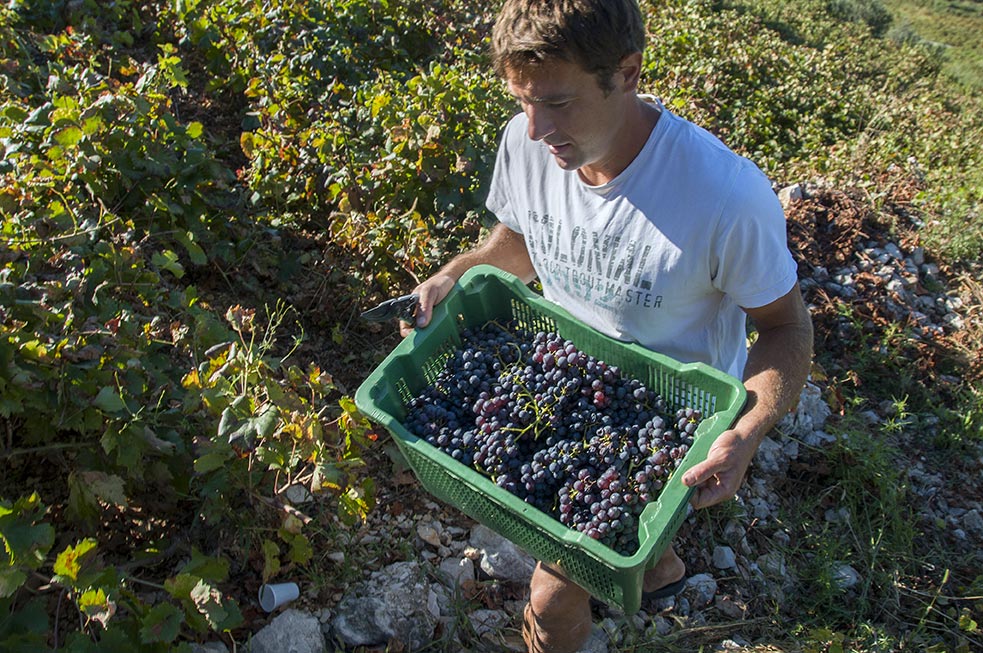
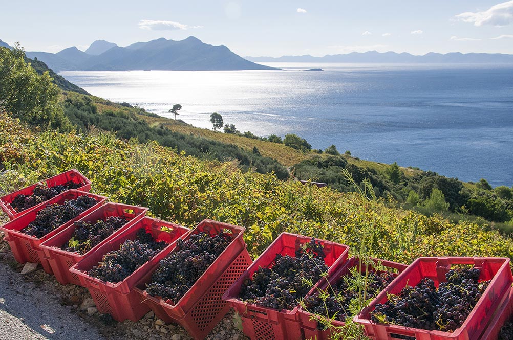
When you moor in harbours on the islands of Brač, Hvar and Vis, take some time to get to know their winemakers and taste some top quality wines. Here, we would like to mention some of the most famous ones. If you are sailing around the islands of middle Dalmatia, you are also sailing in an area which was the cradle of winegrowing and winemaking on the Adriatic. This is immediately clear as you sail along the south shores of Hvar and Brač, and notice the vineyards which are spread from the sea to the rocky summits, taking up almost all workable soil. Since ancient times grapes ripened here on sandy soil, bathed in sunshine. These grapes are used to produce some of the best Mediterranean wines. Even the old Illyrians knew how to grow grapevines, ferment fruit and produce wine, long before the Greek colonization. The arrival of Phoenicians, and especially Ancient Greeks to the Adriatic Sea raised the winegrowing and winemaking technology to a new level. This winemaking tradition has been preserved until today, and winemakers of Hvar, Brač and Vis are considered to be true masters of this ancient art. This area is the origin of many autochthone grape varieties: plavac mali crni, maraština, vugava, bogdanuša, prč, and many others. Keep that in mind when you sail these waters, and when you moor in some picturesque bay or on an island waterfront, be sure to visit some of the islands’ famous winemakers, take a peek in their wine cellars and try their wines. If you like them, replenish your ship’s supplies with a bottle of top quality wine, which will keep your heart warm long after you have left these parts.
For years, all the restaurants, taverns and inns we have recommended to you as places where you can enjoy particularly good food have been entitled to display our sticker, Gustozi đir (Gourmet Tour). The best have been awarded a sticker every year and we are proud to present them here.
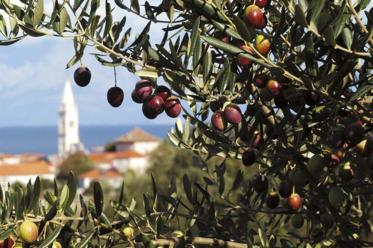
Olives have been part of Mediterranean
culture from the dawn of civilisation, forming part of both the staple and
gourmet diets of the inhabitants, representing a certain style of life and
becoming a powerful spiritual symbol. Olives growing along the Croatian
coastline have been enthused over and envied far and wide in the past, so there
is no reason why they should not become part of the European future.
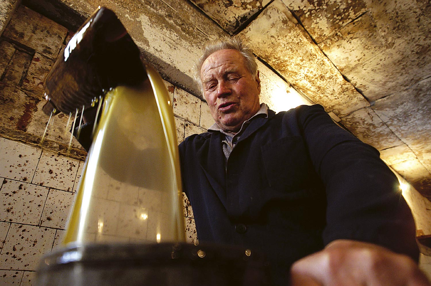
Croatia has a highly
suitable ecological environment for the cultivation of olives and the
production of high quality, virgin or extra vergine olive oil. The development of olive cultivation
and the production of high quality olive oil by introducing new technology
forms an important component in the structural development of Croatian
agriculture.
High quality olive oil (extra vergine) is
more and more sought after for its dietary and therapeutic value. During the
last decade, the production and consumption of olive oil worldwide has
increased by 12%. Increased demand and consumption of extra vergine olive oil
is a particular feature of the countries of the European Union.
Since supply cannot match demand and demand
continues to grow, the price of the best oils is rising steadily, with Croatian
oil characterised by its first-class quality, taking its place among the best
in the world. This is borne out by
experience, so that fine, virgin olive oil from Istria is sold in advance to
France or even Italy, which has its own developed cultivation of olives.
This mooring has always been popular, always en route and always providing a convenient repose or overnight stay. It is a waterway between the islands of St. Peter and somewhat bigger Ilovik. Along either coast there are many mooring buoys, but if none is free, make sure not to drop anchor too far away and get in the way of other boats passing through. The Passage provides good shelter against all winds save for tramontana (a northerly) and summer storms coming from the west. In bora moor in the lee of St. Peter. There is a cute little place on Ilovik which has not been corrupted by recent architecture. As many as five restaurants are open in the summer, which clearly shows how popular this place is.
Koristimo kolačiće kako bismo vam omogućili najbolje korisničko iskustvo na našoj web stranici. Ako nastavite koristiti ovu stranicu, smatrat ćemo da ste suglasni s time.